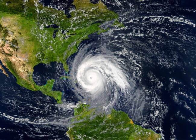
The official start of Hurricane Season begins on June 1st and it runs through November 30, 2020. It is extremely rare for hurricanes to form outside of that window but it’s not completely unheard of. The earliest recorded Category 1 hurricane came in January 1938 and the earliest Category 2 hurricane came in March of 1908. But 97% of all Atlantic tropical cyclones fall between June 1 and November 30.
The 2020 Atlantic Hurricane Season forecast is out and it’s calling for ‘above normal’ action this year. This year’s forecast is predicting there will be sixteen named storms in the Atlantic and eight of those will form into a hurricane.
Of those 8 tropical cyclones that become a hurricane, four of those storms are predicted to strengthen to Category 3 to 5 storms with sustained winds of at least 111 miles per hour. The chances that one of these hurricanes makes landfall in the United States is quite high:
The chance that at least one major hurricane will make landfall in 2020 along the US coastline is 69%, compared with an average over the last century of 52%, researchers said. There is a 95% chance — the average is 84% — that at least one hurricane this year will make landfall in the US.
“The last season with four or more major hurricanes was the record damage-causing year of 2017 that saw Hurricanes Harvey, Irma and Maria,” CNN meteorologist Brandon Miller said. “All caused significant damage in the US and Caribbean.”
Six major hurricanes formed that year in the Atlantic basin. The seasonal average is 12 named storms, including six hurricanes. (via CNN)
According to the report, the ‘Above Normal’ forecast was predicted consistently across several forecasting models and has a high degree of confidence. Researcher Philip Klotzbach told CNN Weather “This year, we used four different techniques to develop our forecast. And they all point towards an active season.”
The prediction of four major hurricanes in one season seems to be an outlier. The Colorado State model hasn’t predicted four major storms in one season since 2013 when there was an El Niño present. The chances of an El Niño this year remain low:
The latest #ElNino model prediction plume has the majority of models predicting ENSO-neutral conditions for peak Atlantic #hurricane season (August-October). Very few models call for #ElNino. El Nino typically reduces Atlantic hurricane activity via increased wind shear. pic.twitter.com/DMORw4ZXqq
— Philip Klotzbach (@philklotzbach) March 19, 2020
These models pull on 40 years worth of data including sea level pressures, water temperatures, El Niño, and vertical wind shear levels. One thing the models are dealing with now more than ever are rising sea temperatures which can throw some uncertainty into the predictions but they all remain confident that this season will see ‘Above Normal’ action.
Time seems to be moving faster than ever before right now but this forecast is a reminder that things can certainly get A LOT worse in the near future. I live in Southwest Florida and know it’s only a matter of time until my city takes a direct hit and we get pummeled back into the 20th century. Meanwhile, almost the entire state of Florida is listed under ‘Moderate Drought’ right now which means the wildfires will begin flaring up any day now. One more disaster to contend with on top of everything.
For more on the 2020 Atlantic Hurricane Season forecast you can click here to visit the report on CNN.
This content was originally published here.

