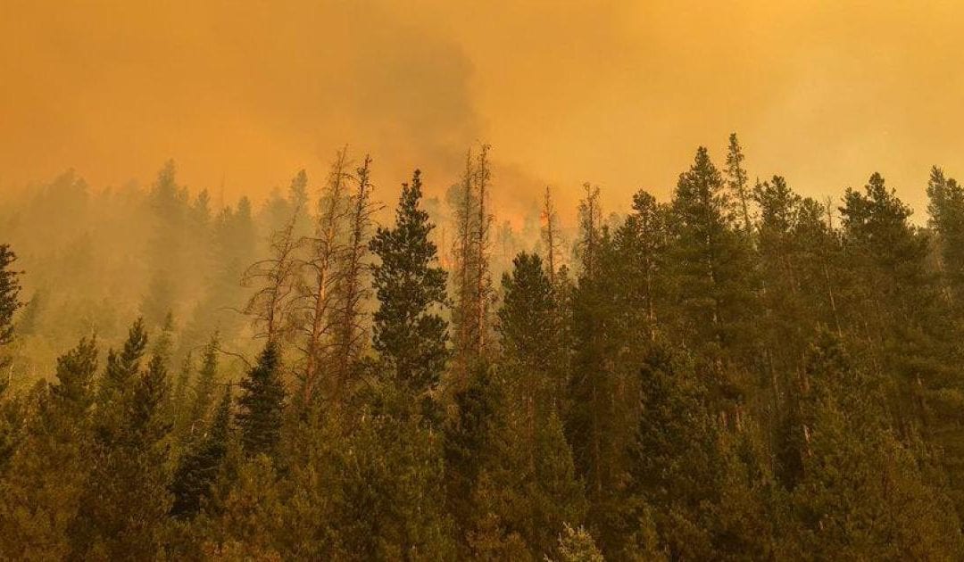
As Colorado experiences a record-breaking wildfire season amid accelerating population growth and statewide drought, many are asking: How can we be resilient in the face of inevitable disaster?
It’s a dense question. To find an answer, the Colorado Water Conservation Board teamed up with the Division of Homeland Security and Emergency Management and a handful of other state agencies to create the Future Avoidance Cost Explorer. The Federal Emergency Management Agency joined the effort as part of its Hazard Mitigation Grant Program, and contracting company Lynker helped with data analysis as well as creating an interactive website. Just a year after the project started, the technical report and the website were published this spring.
Also known as FACE:Hazards, the dashboard explores the economic cost of natural hazards under a variety of different potential scenarios as they might look in 2050. Users can explore varying degrees of climate change and population growth, dive into the economics of one specific economic sector like agriculture or recreation, differences between geographic regions, and peruse the impacts different programs have on disaster resilience.

The price tags estimated for these scenarios are likely lower than they would be in real life, according to Megan Holcomb, senior climate specialist at the Colorado Water Conservation Board and technical lead for the project. This is in large part due to incomplete data; not every county collects the same degree of data on the same economic sectors, for example, so the project could only do analysis when data from every county lined up. Additionally, the data is at a county-level scale, so while it gives a good picture of the state as a whole, cities and towns will need their own assessments for better accuracy.
“We don’t know what parts of economies will be impacted the hardest sometimes,” Holcomb said. “We don’t know where in the state the most serious wildfires are going to happen, we don’t know how that’s going to affect recreation or tourism afterwards. A lot of disasters, by their very nature, are unpredictable … but we just know that these disasters will happen more frequently, and back to back or in conjunction with others.”
Despite its shortcomings, Holcomb says the dashboard and its accompanying technical report can start to fill a much-needed role for decision-makers.
“The Catch-22 of planning far into the future is that’s not how the decision-making process works, and not how funding works,” Holcomb said. “It’s very challenging, but we have to start somewhere.”
While the project could have just been presented as a technical report to legislators, Steve Boand, state hazard mitigation officer and a project adviser, said the team decided from the get-go to make the data more accessible. Not only does this benefit lawmakers who likely don’t have the time to parse pages and pages of data, it also helps communicate the issue in a way that starts a conversation with the agencies like the Office of Emergency Management.
“The goal is for local communities to ask, ‘What do you mean, this is going to cost $300 milion a year, how does that work?’” Boand said. “The general economic impact from fire, drought and flood can be staggering.”
Of the $997,000 dedicated to the project, 75% came from FEMA, with the remainder funded through the state. Ryan Pietramali, recovery division director for FEMA Region 8, which includes Colorado, noted that this is the nation’s first project to take such a thorough look at the practical impacts of disaster planning.
“I can’t commend Colorado enough for really trying to understand what a decision-maker needs as they do large capital improvement projects,” Pietramali said. “My hope is that because this was groundbreaking, other states can pick up on the methodology and follow suit for hazards they have.”
To receive federal funding for disaster assistance, states must update their mitigation plan every five years. Filing the standard type of report gives states access to an additional $15 for every $100 in disaster aid for mitigation work. For wildfire mitigation specifically, that can include education and outreach, clearing potential fire fuels away from houses in the wildland-urban interface, and retrofitting structures to be more fire-resistant. The enhanced nature of the FACE:Hazards project qualified Colorado for up to 25% more funding for mitigation. According to Pietramali, this encourages states to use funds most efficiently.
“The decisions we make on the front end before we build are the most important decision we can make,” Pietramali said. “You build something, a road or school or fire station, and that will be there for 50 to 100 years, so what kind are you going to build, where are you going to build it, how resilient will it be?”

There are other options for communities that want to know more about how wildfires can impact them. The Colorado State Forest Service’s Wildfire Risk Viewer offers an interactive website where anyone can explore the wildland-urban interface, or WUI, in their county and the risk that area has for a wildfire in relation to the rest of the state.
The data was most recently updated in 2017 to factor in “significant disturbances” from recent years, according to Daniel Beveridge, CSFS wildfire mitigation specialist and project manager for the website. Those disturbances include the High Park fire and other fires since the last update in 2012, as well as issues like spruce beetle outbreaks, which can change how a forest would burn if it catches fire.
While the risk index doesn’t offer predictions like the FACE:Hazards dashboard, Beveridge said there’s still value in communicating about the present conditions and offer actionable steps that individuals can take to affect their surroundings.
“A lot of residents actually do recognize their wildfire risk, so we hope to help folks that don’t have that recognition, and give them the tools they need to reduce their risk,” Beveridge said.
Like the Wildfire Risk Viewer, the FACE:Hazards dashboard doesn’t automatically update with new data, so Boand says it’s likely the state will need to revisit the findings in five years or so to keep the model’s predictions accurate. Data from this year alone — hundreds of thousands of acres burned in record-setting fires, with the entire state under official drought classification — will likely change the findings.
Later this week, Boand will recommend to the Office of Emergency Management that every county in Colorado consider the FACE:Hazards data in the next five-year hazard mitigation plan update. As Colorado looks to a future where up to half of its population lives in the WUI, Boand says the last thing Colorado wants is a situation like Paradise, California, a town destroyed by the 2018 Camp fire.
“That is a huge warning sign for our future,” Boand said. “If we know wildfire is a growing threat, let’s give ourselves a chance to survive.”
Our articles are free to read, but not free to report
Support local journalism around the state.
Become a member of The Colorado Sun today!
$5/month
$20/month
$100/month
One-time Contribution
The latest from The Sun
This content was originally published here.

