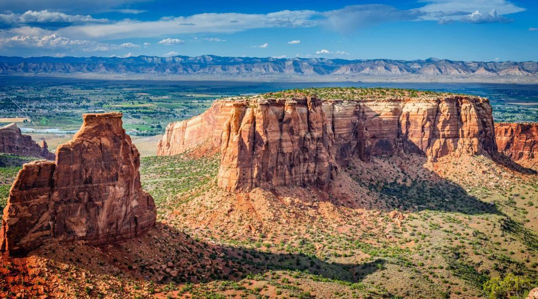
1. Where to Find Colorado National Monument
Find Colorado National Monument in the high desert landscape of western Colorado. The park stretches from Fruita at the west to Grand Junction in the east. The elevations through Colorado National Monument range from 4,700 feet to more than 7,000 feet above sea level. Colorado National Monument is part of the Colorado Plateau, which encompasses other geologic wonders, including Grand Canyon, Bryce Canyon, and Arches national parks.
Photo Credit: boydhendrikse (iStock).
John Otto (Photo) Credit Victoria Stauffenberg, National Park Service
3. Meet the founder of Colorado National Monument
In the age of John Muir, “Father of Our National Park System,” Colorado had its own proponent for wilderness conservation. In 1906, John Otto wandered into the area of what is now Colorado National Monument. He reportedly wrote, “I came here last year and found these canyons, and they felt like the heart of the world to me. I’m going to stay and build trails and promote this place, because it should be a national park.”
Photo Credit: Victoria Stauffenberg, National Park Service (via Wikipedia Creative Commons).
4. Meet the founder of Colorado National Monument (cont.)
John Otto promoted the area of Colorado National Monument by leading fundraising campaigns, petitions, and by writing newspaper editorials and letters to politicians to give the place a national designation. He hand-picked and shoveled trails, named rock formations after heroes and historic events, and eventually became the park’s first caretaker.
At the edge of canyons and through pinyon-juniper woodlands, Rim Rock Drive winds 23 miles through Colorado National Monument from Grand Junction to Fruita. The road passes through cliffs via three tunnels and offers access to amazing canyon views, 19 signed viewpoints, and 14 hiking trails. The men of the Civilian Conservation Corps constructed the road in the 1930s out of the sandstone, mostly by hand. Rim Rock Drive was finished in the 1950s.
7. Follow the Serpent’s Trail, the original road in Colorado National Monument
The original dirt road through Colorado National Monument remains open to hikers, known as Serpent’s Trail. With 54 switchbacks in just 3.4 miles (roundtrip), Serpent’s Trail is the most popular hike to take at Colorado National Monument. This is one trail built by the legendary John Otto and is included in the National Register of Historic Places as of April 21, 1994.
Discover sandstone towers in Colorado National Monument with the most significant being Independence Monument, named by John Otto. In 1911, Otto climbed the 450-foot-tall Independence Monument and planted the United States Flag, which is a continued tradition for Mesa County Technical Rescue Team rock climbers each 4th of July.
Another rock formation is Liberty Cap, which also still uses the name Otto gave it. Liberty Cap is “a 160-million-year-old remnant sand dune that is slowly succumbing to the forces of erosion,” the trail sign reads. Don’t miss more rock formations like the Kissing Couple and Coke Ovens.
Some of the large canyons at Colorado National Monument are Monument Canyon, Wedding Canyon, Ute Canyon, and Red Canyon. Monument Canyon is the park’s main attraction as it runs the width of the park.
Thanks to John Otto, an array of hiking trails exists in Colorado National Monument for any level of hiker. Otto built the first trails into the high desert landscape, which can be rugged in many sections. The 14 hiking trails range from 0.5-mile to 14 miles round trip. Even the shortest of hikes lead to views of the towering rock formations, canyon walls, and more, such as the Window Rock Trail, Canyon Rim Trail, and Otto’s Trail. Click here for a descriptive list of more hiking trails at Colorado National Monument.
Photo Credit: Maxfocus (iStock).
This content was originally published here.

