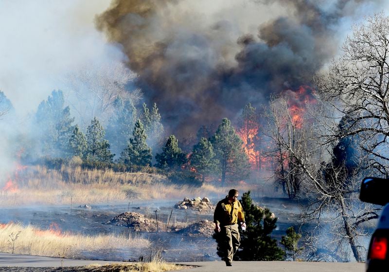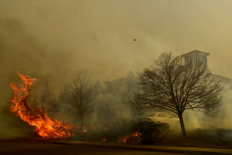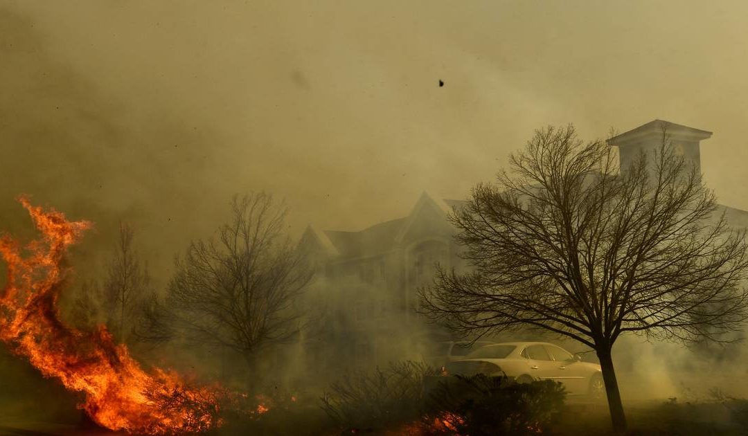
The raging inferno that erupted in Boulder County, Colo., on Thursday afternoon became the most destructive wildfire in the state’s history as it burned through hundreds of homes in densely populated suburbs. The fire was fueled by an extreme set of atmospheric conditions, intensified by climate change, and fanned by a violent windstorm.
The fire came at a time of year when a blaze of such violence is unprecedented; Colorado’s fire season typically spans May though September. But exceptionally warm and dry conditions through this fall, including a historic lack of snowfall, created tinderbox conditions ripe for a fast-spreading blaze.
All that was needed to incite such a conflagration was a spark and that was provided by a ferocious windstorm, rushing down the slopes of the front range. As the winds – gusting over 100 mph – toppled power lines, the inferno was ignited.
According to climate scientists, extreme fires tend to be “climate-enabled and weather-driven”; this was a classic case and one that is projected to become more frequent as the planet warms.
[]
The climate conditions for Thursday’s fire outbreak strangely began with a wet, snowy spring. In March, a major snowstorm dumped one to two feet of snow across the Front Range and brought much-needed moisture to all of eastern Colorado. The active storm pattern continued through the spring. All this spring moisture helped grow the grasslands that dominate the land cover for all of Colorado, east of the Rocky Mountains. By the start of summer, the lower elevation plains east of the mountains were lush and green.
Chris Bianchi, a broadcast meteorologist for 9News in Denver, described “relentless waves” of moisture. “They likely saved us from what probably would’ve been a horrific summer of wildfires,” Bianchi wrote in an article. “But all that moisture helped vegetation blossom during the late spring and early summer.”
The newly grown vegetation turned into fuel for Thursday’s fire once it became desiccated by months of drought. At the end of July, drought affected just 40% of Colorado according to the U.S. Drought Monitor; as of Wednesday’s update, that number was 100%.
The timing of drought onset was unusual. Rapid increases in drought severity in Colorado typically occur in the spring and summer months. Seeing this deterioration in the fall and winter was much more rare.
The drought was particularly severe east of the Rocky Mountains, including near Boulder, with almost a complete lack of snowfall in the past few months. Boulder averages over 30 inches of snow between September and December; this year only around an inch has fallen. Just 1.6 inches of precipitation (from rain and melted snow) has fallen since Aug. 1.
The drought level where the fires erupted was “extreme,” the second-highest category.
Unusually warm conditions intensified the drought; they began this summer and continued through this week.
“From June 1-Dec 29, the Front Range has been the warmest on record (by far),” tweeted Russ Schumacher, Colorado’s state climatologist on Thursday.
Between June and November, Colorado’s statewide temperatures ranked in the top 10th percentile.
The combination of warm and dry conditions led to worrisome indicators of fire danger.

The Evaporative Demand Drought Index, or EDDI, has been record high in eastern Colorado over the last month. Most commonly used in the summer, EDDI provides a snapshot of how “thirsty” the atmosphere is, compared to normal for that time of year. When EDDI is anomalously high, it means the atmosphere is trying to take more moisture out of the ground. It can be a good wildfire risk predictor as it takes into account temperature, sunlight and wind, in addition to humidity.
Another key indicator of fire conditions, known as the Energy Release Component (ERC), was also dangerously high along the Front Range communities. According to the Forest Service, ERC is a composite index that “reflects the contribution of all live and dead fuels to potential fire intensity.”
Rip-roaring winds
While the warm, dry conditions in recent months generated the fuel for the fire, an unusually strong windstorm helped the blaze spread at breakneck speeds. The fast-moving air not only fanned the flames with oxygen but also scattered burning embers resulting in multiple fires. Radar detected the smoke plume from the blazes over 100 miles downwind well to the east of Denver.
The winds developed as a strong low-pressure zone intensified in the lee of Rocky Mountains. The mountains were tall enough to act as a block between high pressure centered over New Mexico and the strengthening low-pressure zone to the east, allowing a large difference in pressure to develop from west to east over the Rockies. Differences in pressure create wind and the air moving from high to low pressure ripped over the mountains.
As the air descended the mountain peaks, it accelerated and warmed due to compression. This heating of the air occurred without any addition of moisture, causing humidity levels to dramatically decrease as the air rushed downslope. The gusts that blew at the surface were thus exceedingly strong, dry, warm and able to incite extreme fire growth.
Gusts exceeded 70 mph at Boulder Airport on Thursday afternoon, and even topped 100 mph at more open, exposed areas.
These types of downslope wind storms, sometimes called Chinooks, are not uncommon in the Colorado Front Range. But this event was on the strong end of the spectrum.
“[A]lthough we’re in the heart of downslope windstorm season in late December, the winds today were extreme,” Schumacher tweeted. “At the National Wind Technology Center [just south of Boulder], the max gust of 98 mph was the strongest since November 2015.”

Climate change connections
This historic and devastating fire isn’t a one-off event, but fits into a pattern toward larger fires in both Colorado and other parts of the West in recent years, as well as an expansion of the fire season to practically year-round.
Data from Colorado’s Division of Fire Prevention and Control show that four of the five largest known wildfires to affect the state have occurred in the past three years, including the top three in 2020. To the west, California has seen its seven largest fires on record since 2018, including five of the top seven in 2020.
Scientists have published numerous studies tying more extreme fire behavior to higher temperatures and more intense drought, both linked to human-caused climate change.
The higher temperatures, shifting conditions previously more characteristic of September and October to November and December, are also extending the fire season. This year unusually late fire activity has not only occurred in Colorado but also in Montana and the western Plains.
“With CLIMATE CHANGE, there is no FIRE SEASON anymore,” tweeted Mike Nelson, chief meteorologist for Denver7, the city’s ABC affiliate.
This fire disaster also casts light on the danger of building and development into the zones prone to wildfire or what scientists call the wildland-urban interface, which is becoming more vulnerable with climate warming.
“This is just ENTIRE suburban neighborhoods burning out of nowhere,” tweeted Seth Haber, founder of Trek Light Gear, a Colorado-based business. “Hundreds & hundreds of homes, shopping centers, hotels, small businesses & restaurants gone. I’ve never seen anything like it & never thought it was possible.”
“One lesson that is going to be learned, yet again, in the aftermath of today’s devastating Boulder County, CO fire is just how far into the suburbs the … interface actually extends given sufficiently extreme drought and wind conditions,” tweeted Daniel Swain, a climate scientist at UCLA.
Climate change only increases the risk from fire to people residing along this perilous interface.
“Our warming climate is enabling more opportunities each year & human activities / infrastructure are providing ignitions,” tweeted Phil Higuera, a professor of fire ecology at University of Montana.
– – –
Jason Samenow is The Washington Post’s weather editor and Capital Weather Gang’s chief meteorologist. Jacob Feuerstein is a college junior studying meteorology at Cornell University. Becky Bolinger is the assistant state climatologist for Colorado and a research scientist at Colorado State University.
This content was originally published here.

